


The History of LIC Ramps Lands Space

Oct, 2001 - NYC City Planning, Queensboro Bridge Ramp Land Study

Oct, 2001 - NYC City Planning, Queensboro Bridge Ramp Land Study Conti-

2013 - RockRose commissions Mathews Nielsen on a “Concept Proposal” and advocates to City to convert the DOT space into Public Space in conjunction with other stakeholders such CSCA, Community Board 2, and others

Oct 2018 - As part of a ULURP process where the City sold DOT Air Rights to a Developer to increase the building density (FAR), the City agreed in exchange to convert part of the DOT Lots into Public Green Space with $5.5M in funding provided for initial design build-out and maintenance of the newly public space.

2019 - Existing Dutch Kills Site Use by DOT to store vehicles.
What could be:
The land surrounding the approaches to the Ed Koch Queensboro bridge remain the last publicly owned parcels of land in Court Square. We can create dynamic public spaces to stitch together parts of our community that are currently physically divided from one another.
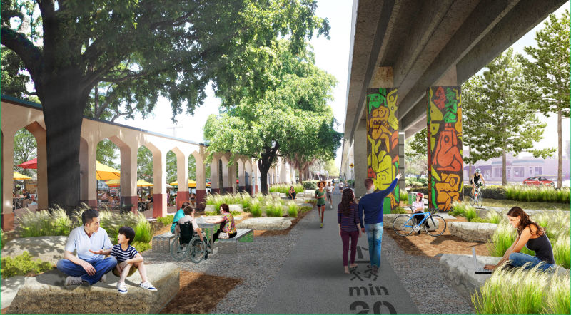
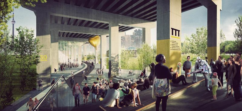
The LIC Ramps, a concept originally proposed by City Planning, is our inspiration for transforming this underutilized public land into the center of our community. As you'll see, overpasses only bisect parts of the open parcels, leaving opportunities for sunlight to stream through. Similar approaches have been taken within NYC (FDR Drive in Lower Manhattan), as well as in cities across the world (Toronto, Chicago, Amsterdam, Boston, Milwaukee).

3.74 Acres /
163,000 Square Feet
of closed-off publicly owned land that could be re-envisioned to stitch together our community and provide spaces for us to gather

Plenty of Sunlight
The parcels of land beneath the overpasses are larger than the diagonal ramps above, allowing sunlight to come through.
Infinite Possibilities
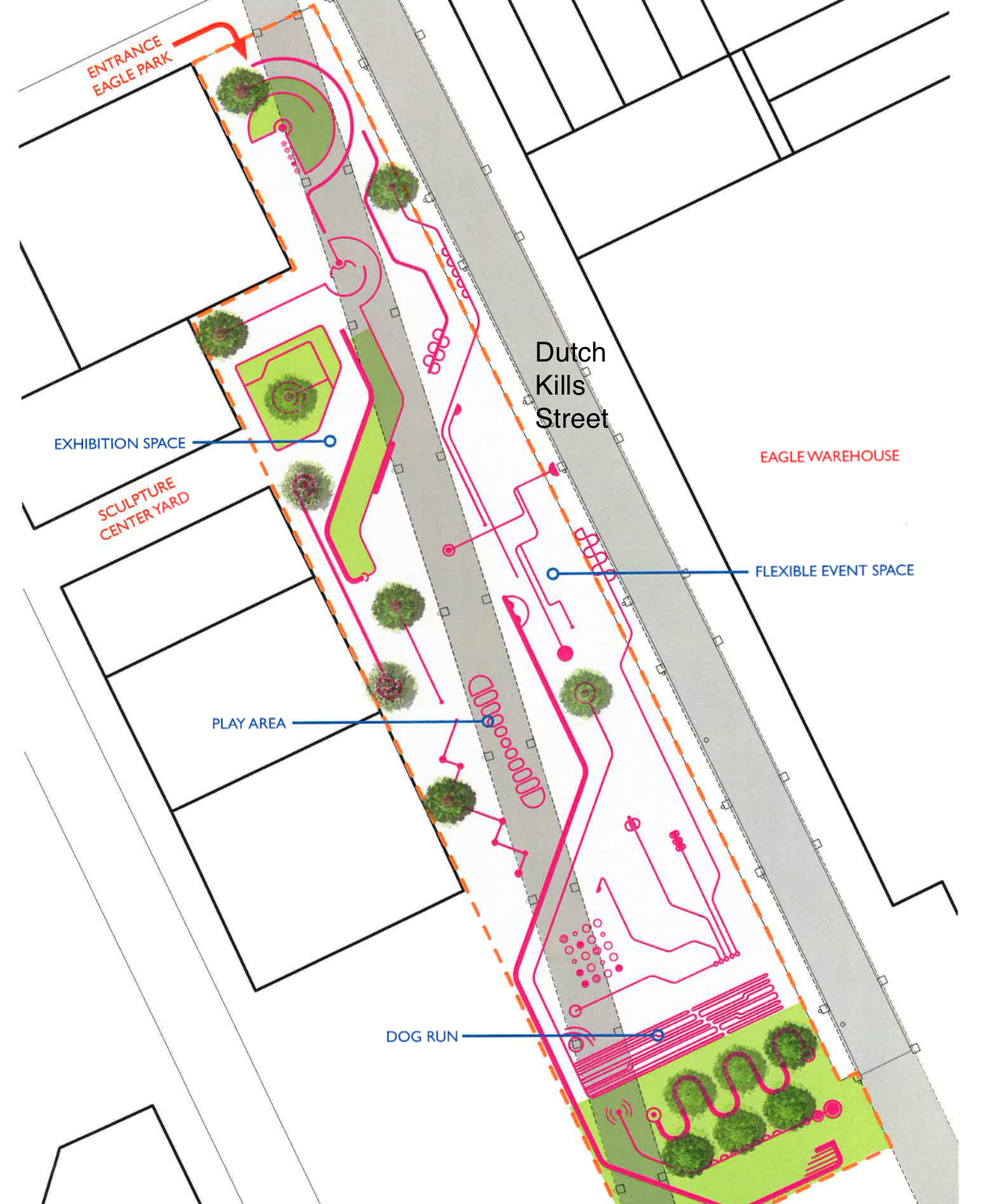
The diversity of spaces throughout the ramplands can be adapted to serve different needs within our community - dog run, play areas, event spaces, biodiversity, public art, hang out space...
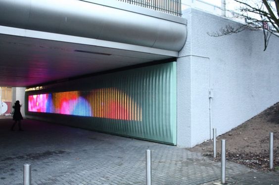
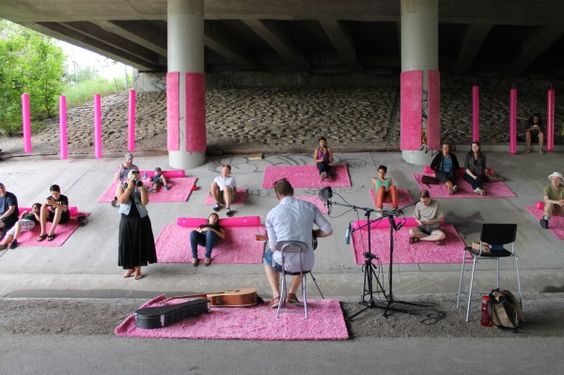
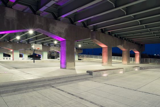
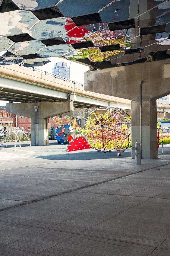
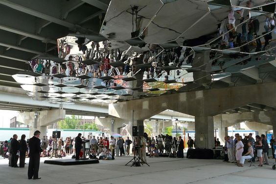
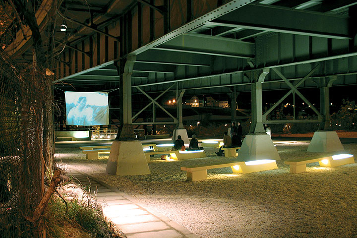
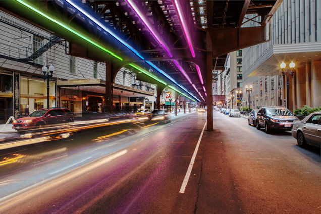
Underpass Parks Around the World
Resources
Original LIC Ramplands Proposal, NYC City Planning 2001
Eagle Park Concepts, Rockrose, 2013
All renderings for conceptual purposes only and do not reflect any final plans for our neighborhood